Diving into sub-daily observations of Sargassum aggregations to improve seasonal forecasts
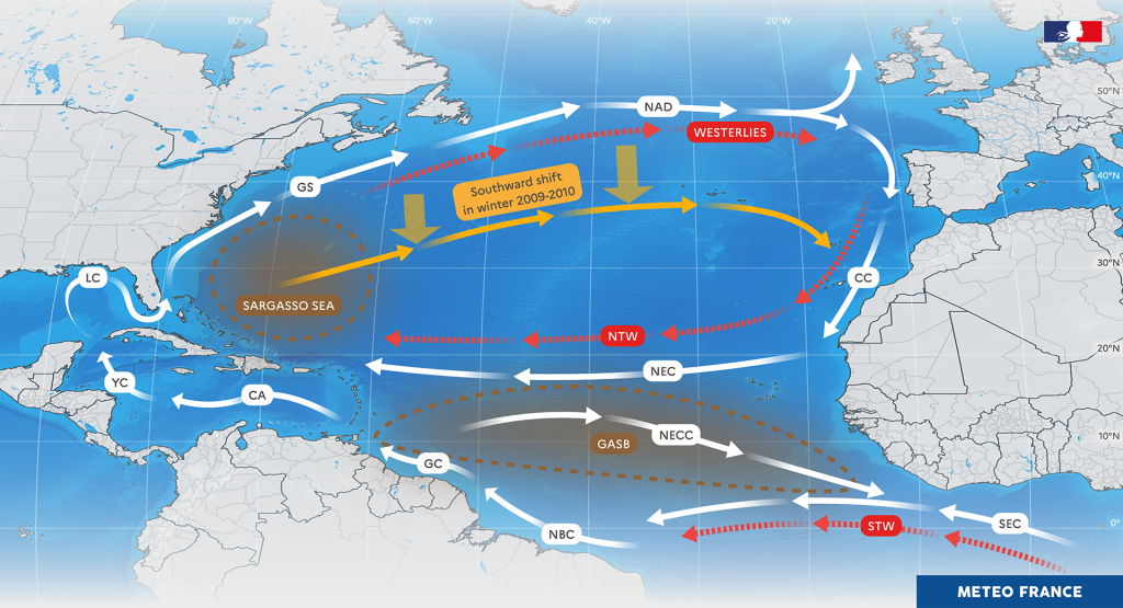
SAMOUSSA is an innovative research project designed to address the urgent need for monitoring and forecasting Sargassum aggregations across the tropical Atlantic Ocean, with a strong focus on local and regional adaptation.
Its originality lies in the innovative combination of geostationary satellite observations and ocean biogeochemical modeling, aiming to better understand and anticipate the impacts of Sargassum on both public health and the environment in the French Caribbean islands.
The project’s ambition is to establish a systematic monitoring system of Sargassum proliferation and life cycles across the Atlantic Basin, in direct support of Météo-France’s institutional mission, a unique public service in Europe and helping Caribbean communities anticipate and adapt to this growing environmental threat.
News
Kick-off meeting
The SAMOUSSA team is delighted to announce the launch of the project at a meeting on March 28, 2025. This meeting will kick off the various activities. In particular, the remote sensing part will feed the model initialization. The main objective today is to obtain the first results by the end of the year, in […]